Navigation Software Just Got a Lot Better
| overview | charts | planning | cruising | features | trial | purchase |

Coastal Explorer help you manage your Chart Portfolio with several different views, including a tabular list of charts, a thumbnail view, and a world-map view to show coverage.

Other Chart Portfolio features make installing or updating charts very easy. Coastal Explorer will even automatically "Un-Zip" and install chart sets that you download from NOAA or the USACE websites!

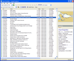
Click here to see full the size screen shot Detailed List View

The detailed list view shows you the chart number, title, scale, type, and the date of the last update. Select any chart to see a thumbnail and many other chart details.

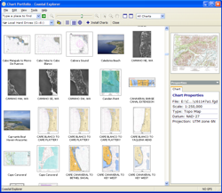
Click here to see full the size screen shot Thumbnail View

The thumbnail view shows you a thumbnail of each chart. Aerial photographs from Maptech® ChartKits are also shown here.

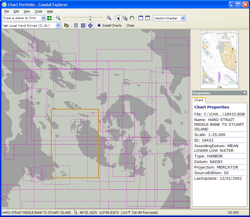
Click here to see full the size screen shot World-Map View

The world map view shows you where you have chart coverage. You can scroll around and zoom in and out on the world map to see exactly where your charts are.

| overview | charts | planning | cruising | features | trial | purchase |

COPYRIGHT © 2003-2004 ROSE POINT NAVIGATION SYSTEMS, LLC. ALL RIGHTS RESERVED.